MAPPING OUR SETTING – Samples & Activities
Here’s a downloadable PDF that you can use to invent your story setting. Click the Download button below, then fill out the text fields digitally, or print the file, fill in the questions, and draw a rough sketch of your map on the last page. You can use any kind of paper you have around the house to figure out and finalize your map. Have Fun!
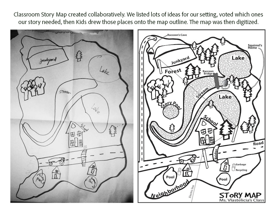
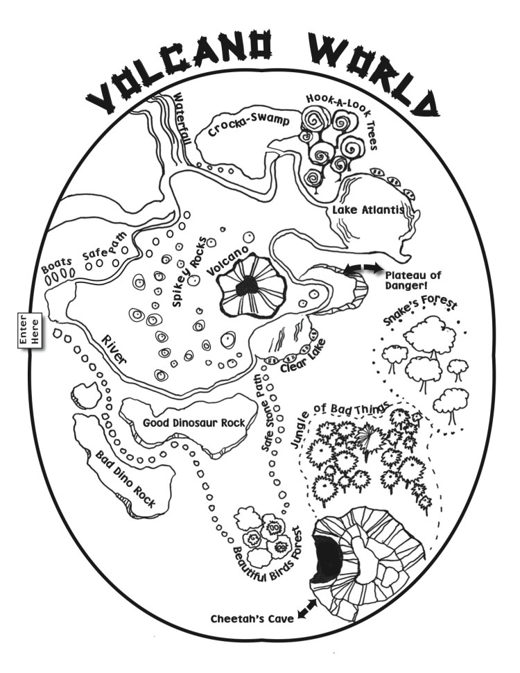
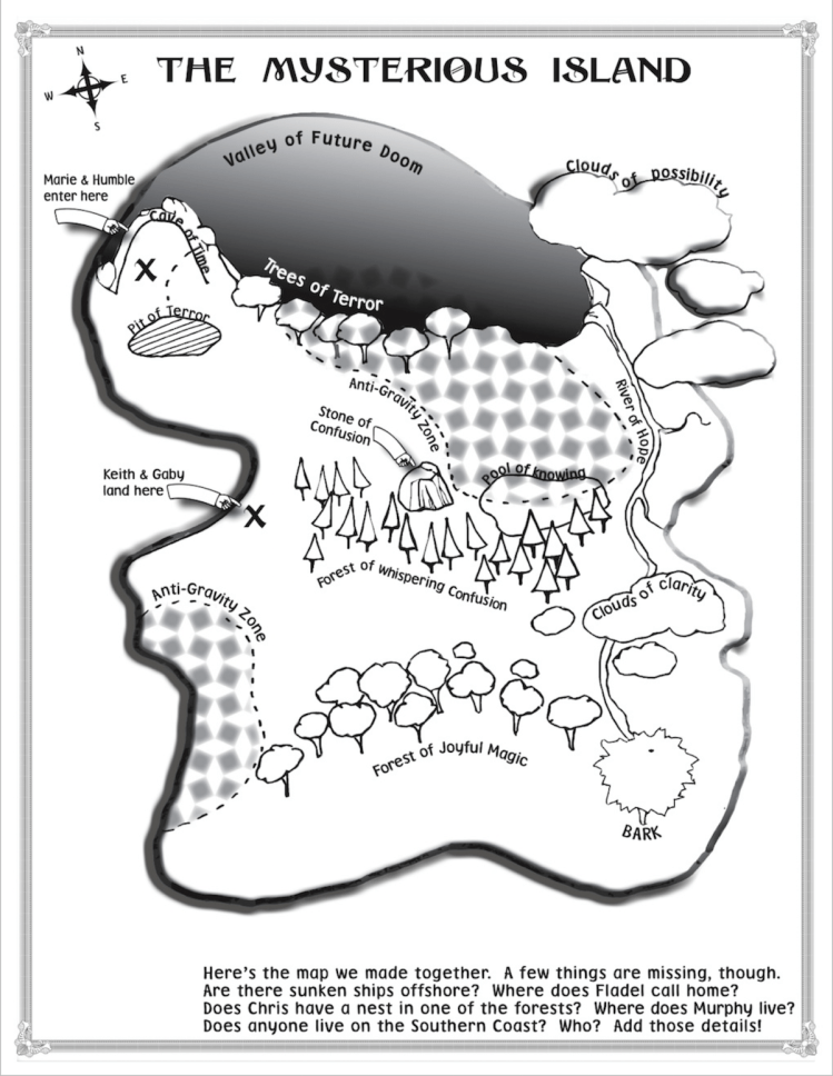
A Map of your Story’s Setting can be very helpful. You can show where your characters live, where they play, go to school, have adventures – details that spur your characters to action. Below are sample maps created by kids in K-5 classrooms, and a bit of information about how we made them. Most of these maps are drawn using the ‘birds-eye’ view perspective, as if we were a bird flying above the earth and looking down. Your map can be as simple or as complex as you want it to be!
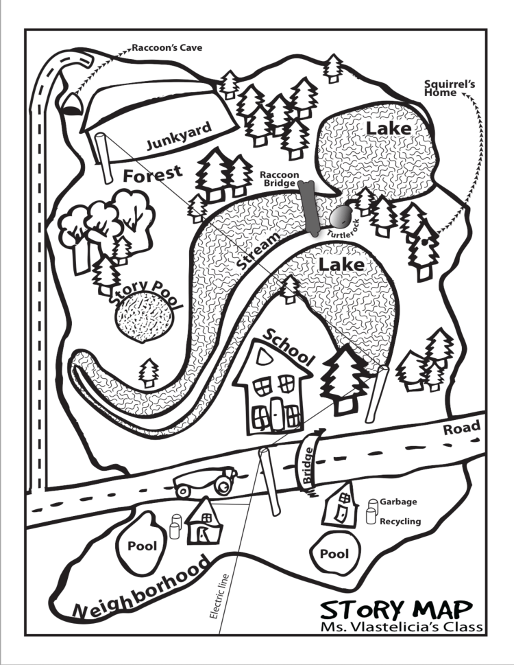
Kids created this Map to accompany their story about neighborhood animals. 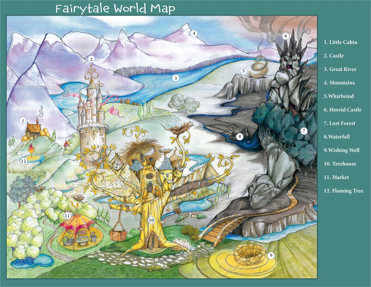
Four Classes of 3rd graders invented all the places on this map which they used to invent Folk Tales. 
Kids used this map on a field trip to a neighborhood wetland. It helped them discover places for their characters to interact. 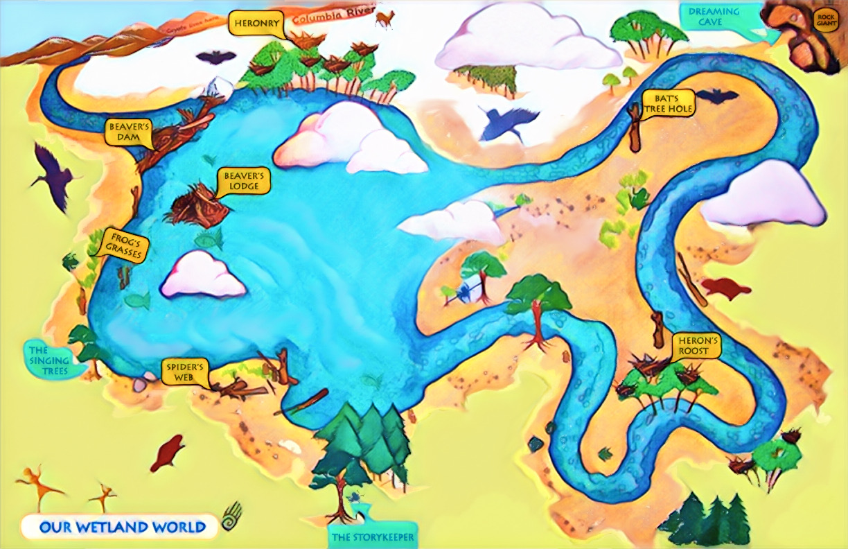
Used by Grades 4-5 classroom learning about wetland habitats. 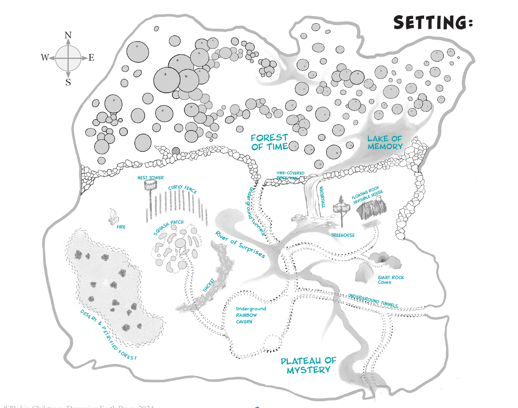
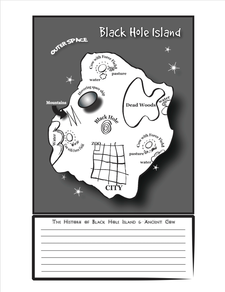
Pohdo’s Island
The Fairytale Map (in slide-show above) was not drawn in birds-eye view. It’s more like an illustration of a Fairytale World with a foreground – up close, where the treehouse is – and a background – in the distance, where the river and mountains are. For this project, four classrooms created one setting and, as you can see, there are many places for action to happen…maybe a few too many? Each classroom got to invent 3 setting details, then they used the whole map to create their individual stories.
Also above is a map made of a real place – a wetland park close to the kids’ school called ‘Whitaker Ponds.’ While on a field trip, we learned about the animals that live there and explored their habitat. We saw blue herons, a beaver dam, wood ducks, dragonflies, and wild rabbits as we gathered story ideas. The map labeled ‘Our Wetland World’ was used in many classrooms during Earth Arts NW residencies by kids who were learning about habitat and animals, and creating stories about them.
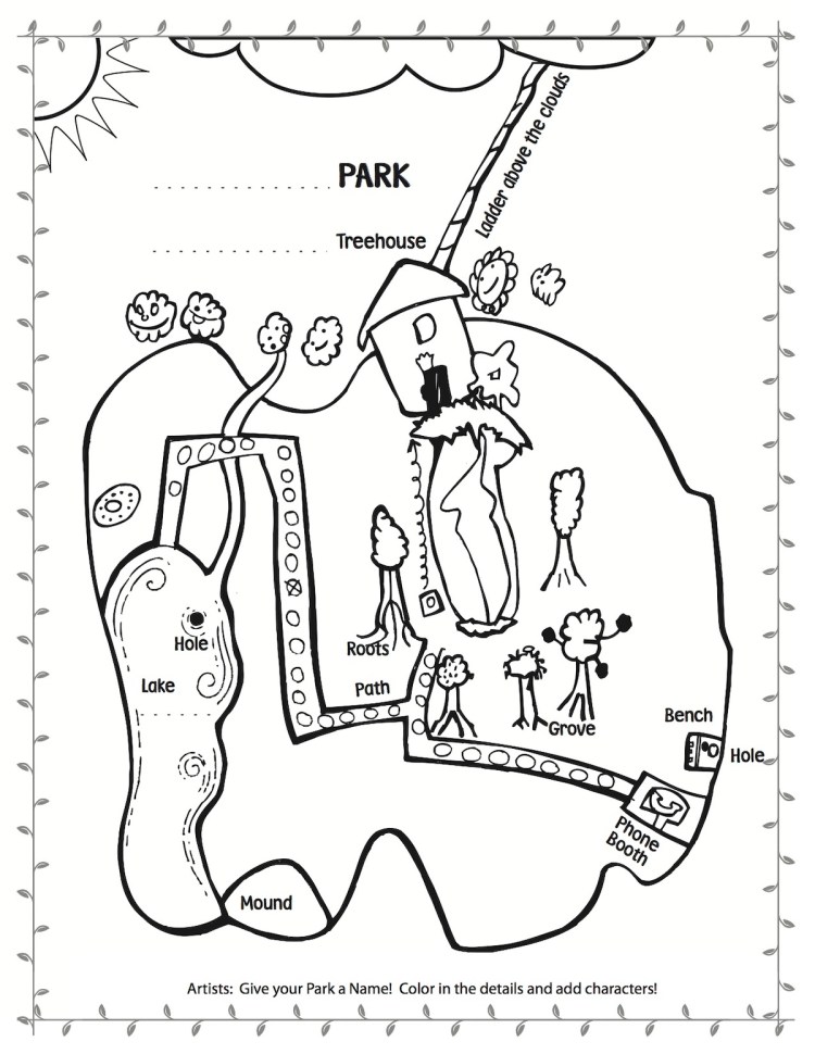
Here are more examples of story settings created collaboratively by grades K-5 school kids.

SHARE YOUR SETTING IDEAS HERE


